|
BC Highway
|
|
iPhone app for Highway Cameras on British Columbia's highway network
|
|
|
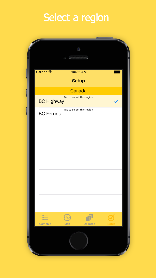 |
Tap BC Highway to select
|
|
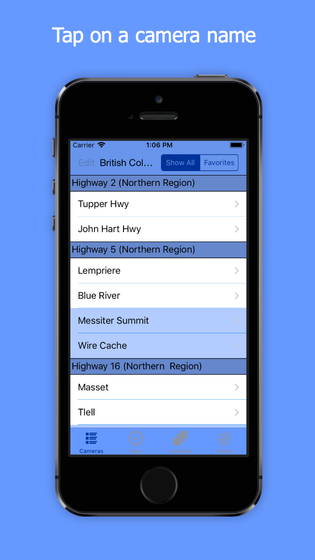 |
List view provides one-tap access to 881 cameras
Scroll down for other highways
Highway 2 (Northern Region)
Highway 5 (Northern Region)
Highway 16 (Northern Region)
Highway 27 (Northern Region)
Highway 29 (Northern Region)
Highway 35 (Northern Region)
Highway 37 (Northern Region)
Highway 97 (Northern Region)
Highway 113 (Northern Region)
Highway 118 (Northern Region)
Trans Canada Highway (Southern Interior)
Highway 3 (Southern Interior)
Highway 3A (Southern Interior)
Highway 3B (Southern Interior)
Coquihalla Highway 5 (Southern Interior)
Highway 6
Highway 20 (Southern Interior)
Highway 23 (Southern Interior)
Highway 24 (Southern Interior)
Highway 31 (Southern Interior)
Highway 33 (Southern Interior)
Highway 43 (Southern Interior)
Highway 93 (Southern Interior)
Highway 95 (Southern Interior)
Highway 95A (Southern Interior)
Highway 97 (Southern Interior)
Highway 97A
Highway 97C (Okanagan Connector)
Highway 1 (Ironworker's Memorial Bridge to Port Mann)
Highway 1 (Fraser Valley)
Highway 7 (Lougheed Highway)
Highway 9 (Lower Mainland)
Highway 10 (Surrey)
Highway 11 (Abbotsford Mission Hwy)
Highway 15 (Surrey-Whiterock)
Highway 17 (Delta)
Highway 17A
Highway 91A (New Westminster / Queensborough)
Highway 0 (Knight St)
Highway 91 (Alex Fraser Bridge)
Highway 91 (East-West Connector)
Highway 91 (Delta)
Highway 99 (Whistler to Lillooet)
Highway 99 (Sea-to-Sky Highway)
Highway 99 (Lions Gate Bridge)
Highway 99 (Oak Street Bridge)
Highway 99 (George Massey Tunnel)
Highway 99 (Delta)
Highway 99 (Surrey - White Rock)
Highway 99A (King George Blvd)
Highway 101 (Sunshine Coast)
Highway 11 (Canada/US Border Crossing
Highway 13 (Canada/US Border Crossing)
Highway 15 (Canada/US Border Crossing)
Highway 93 (Canada/US Border Crossing)
Highway 99 (Peace Arch Border Crossing)
Highway 1 (Vancouver Island)
Highway 4 (Vancouver Island)
Highway 14 (Vancouver Island)
Highway 17 (Vancouver Island)
Highway 18 (Vancouver Island)
Highway 19 (Vancouver Island)
Highway 28 Gold River Highway>
Tap Favorites to switch to your custom list of favorites
|
|
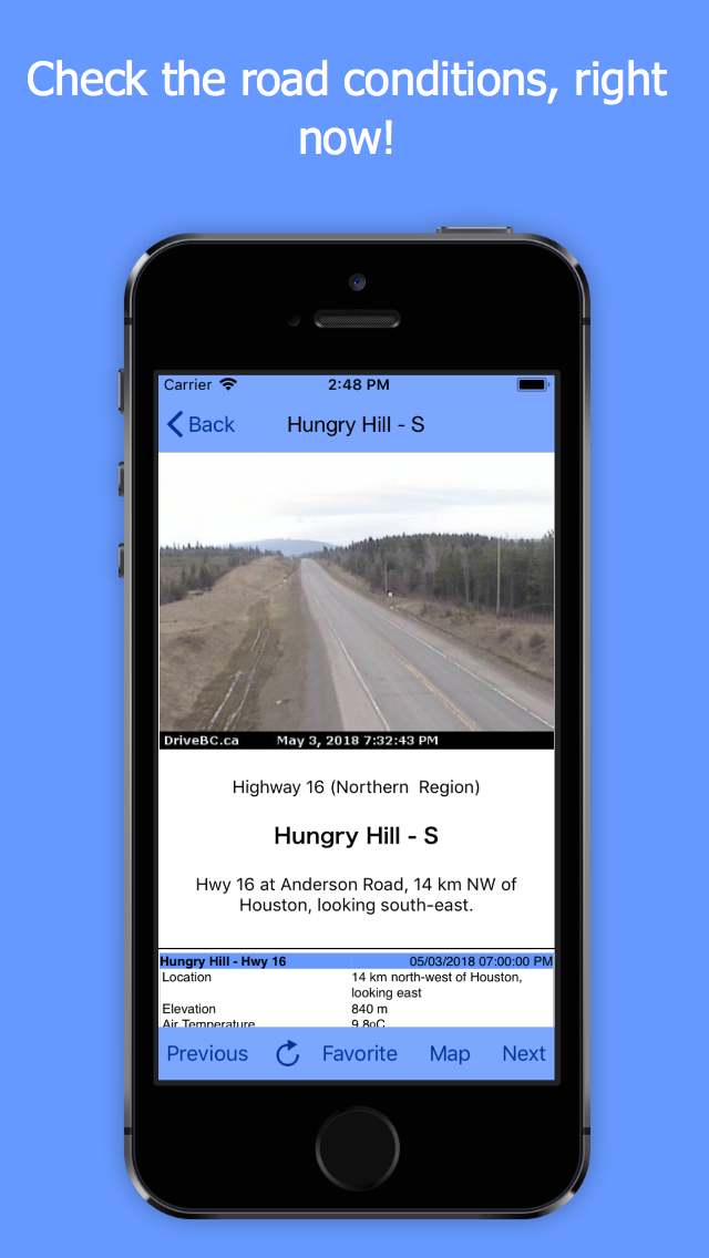 |
Camera view
View the current traffic conditions
Camera network updates the snapshots every few minutes
Tap Previous or Next to view the next camera on the highway
Tap Favorite to build a custom list of the cameras that matter to you
Tap Map to see the camera location
|
|
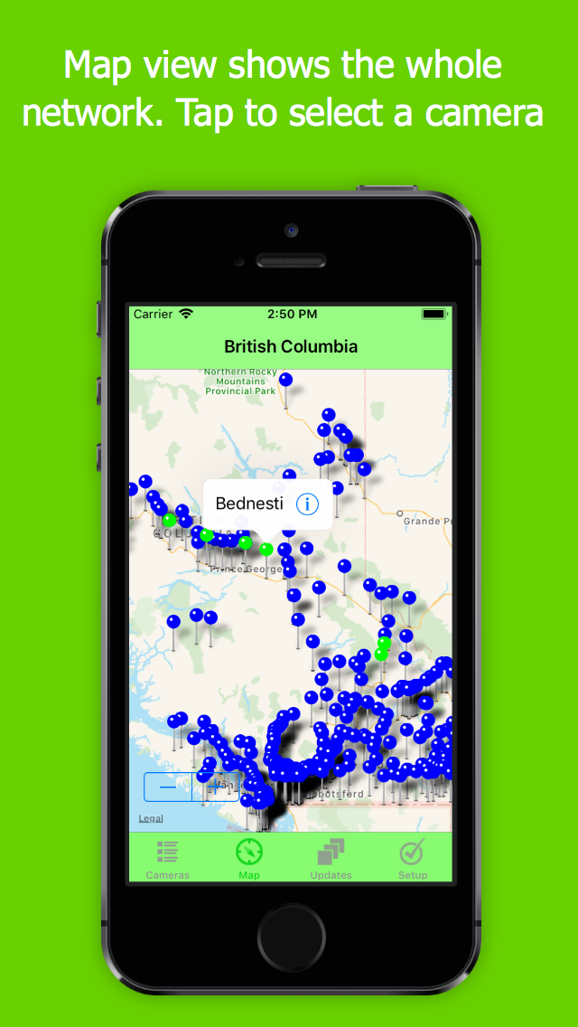 |
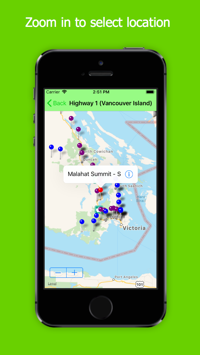
Map view
View the whole network or zoom in to select
Tap a pin to identify a camera
Tap the i to switch to camera view
|
|
 |
Map view selected from Camera View
Selected camera is highlighted
Zoom to view congestion indication
Tap < Back to return to Camera View
|
|
Download the app
BC Highway cameras are now included in our DOT Traffic app which covers cities and regions in Canada and the USA.
Purchase DOT Traffic from the App Store

DOT Traffic
|
|
|
|
Contact
|
|